Hi All,
I am looking to buy a Investment property in Norther Brisbane (Aspley,Fitzgibbon) area and was wondering what is the best way to look at the flood maps of the area?
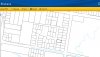
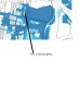
I had a look at the Brisbane city council website and also checked the overlay maps (interactive maps) which are very good but in flood section it shows three different options river,creek,overland. I am not sure which once should I use.
I was wondering if there is any simple way of checking for flooding in area. I also had a look at individual property flooding report but it does not provide any information of the street.
Thanks
I am looking to buy a Investment property in Norther Brisbane (Aspley,Fitzgibbon) area and was wondering what is the best way to look at the flood maps of the area?
I had a look at the Brisbane city council website and also checked the overlay maps (interactive maps) which are very good but in flood section it shows three different options river,creek,overland. I am not sure which once should I use.
I was wondering if there is any simple way of checking for flooding in area. I also had a look at individual property flooding report but it does not provide any information of the street.
Thanks